Title |
N33° 51.917' E130° 47.808' |
Date |
2002-01-28 - 2002-02-15 |
CCA Kitakyushu Project Gallery presented a new work by gruppo A12.
How would it be possible to draw a map of Kitakyushu from zero, and which would be the instruments and the strategy to be used?
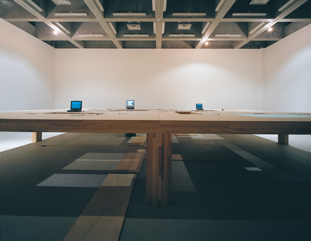
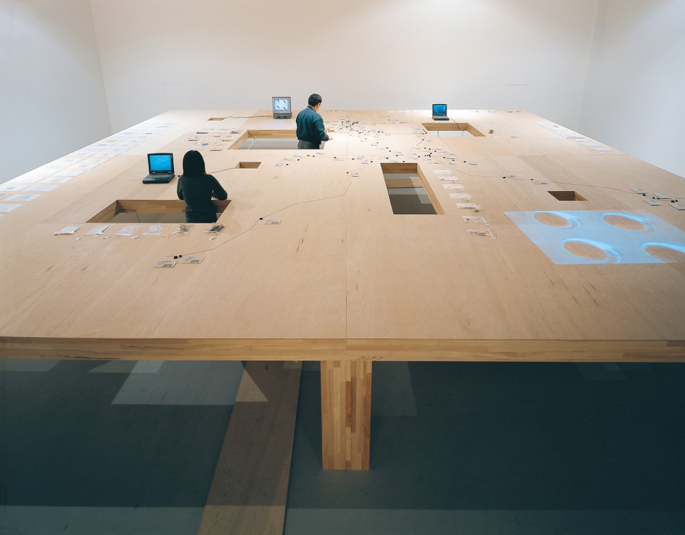
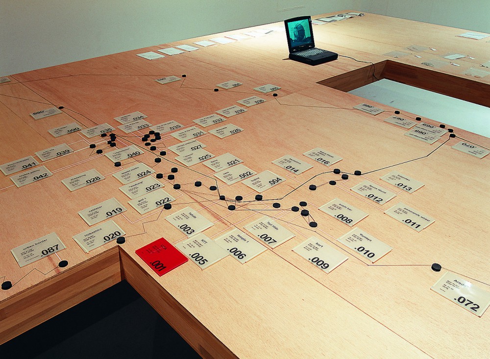
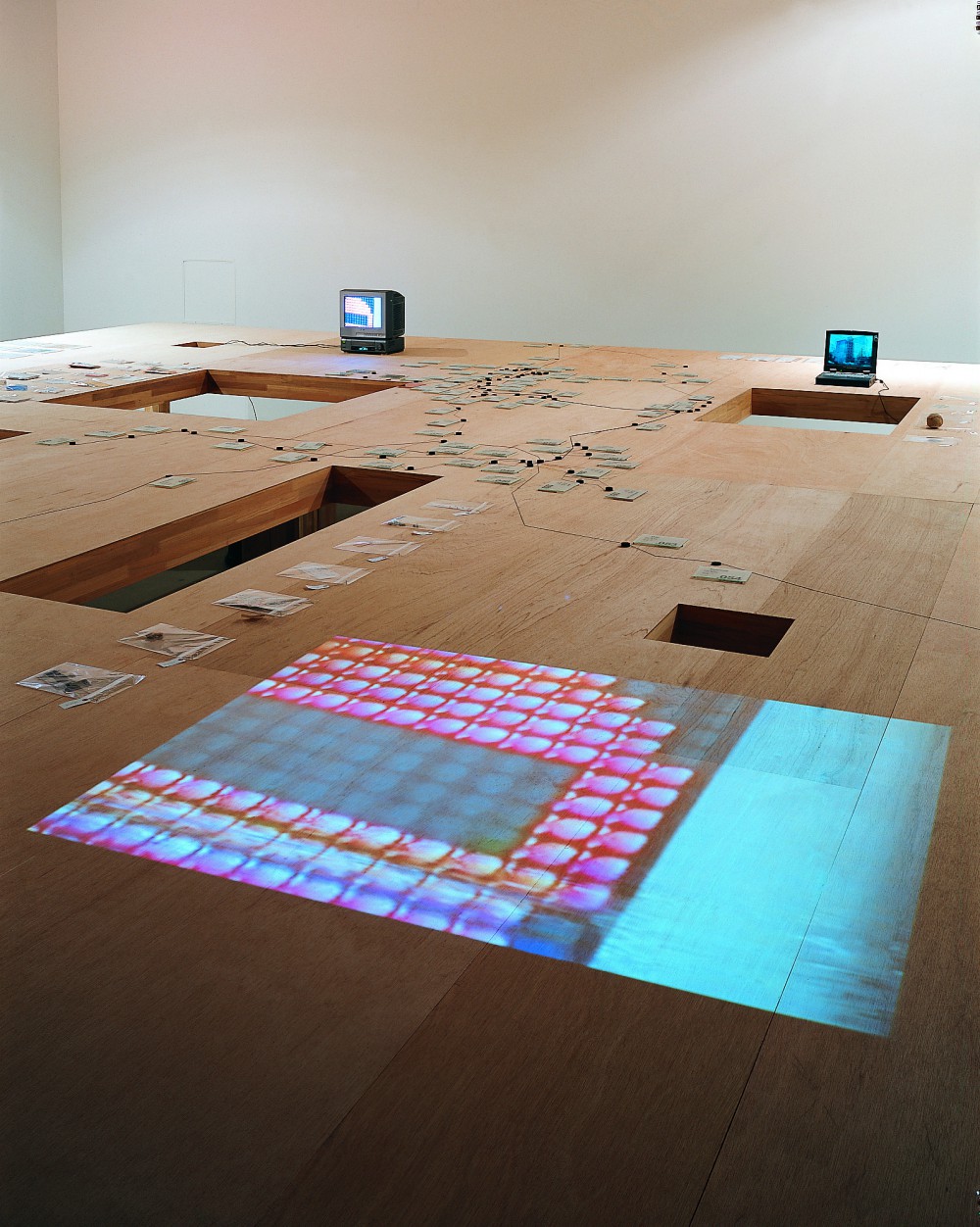
Around these two questions revolved the project, which aimed to draw a map of an unknown territory, in this case Kitakyushu, trying to replicate the attitude and the operations of ancient explorers and geographers. Establishing an artificial condition of lack of information, being lost and needing to define a pattern to orient movement throughout the city, perceived as a “terra incognita”, permitted to give evidence to predefined ideas, attitudes, tendencies, ways of looking which are pertinent to the observer. What becomes recognisable was the way the city and the territory are described according to the cultural background of the authors.
The first operation consisted in the creation of an unnatural condition, avoiding use of already existing maps of that city. A GPS receiver was used to record routes, tracks and significant points of several explorations performed in a span of two months. Data provided by the GPS receiver were poured into a CAD drawing, in order to obtain a representation of the several derives throughout the territory of Kitakyushu, as well as a visible skeleton where to attach notes, sketches, objects found during the wanderings, pictures, short movies. The use of precise electronic systems, derived from the American military industry and research, was performed in analogy to the tradition of geographical explorations of the 19th century, when the use of scientific tools permitted to define a frame of reference for the record of subjective experience. Rumours, hunger, climbing to higher point to obtain an overall view of the landscape, suggestions from locals and travellers, randomness, weather, transportation systems, thirst, curiosity, familiarity and memory, shaped the paths to be followed during the movements around Kitakyushu. The map, rather than being an objective a two-dimensional representation of a given territory became an extended “carnet de voyage”, which gives evidence to the process of discovery and wandering. N33 51.917′ E130 47.808’’ is the latitude and longitude of CCA in Kitakyushu.
gruppo A12 stayed at CCA Kitakyushu as Professors of Research Program from December 2001 to January 2002.
This post is also available in: Japanese